Impact Of Coastal Erosion In Australia
Impact Of Coastal Erosion In Australia
Article by Professor Andrew Short, Senior Coastal Scientist, Coastalwatch/CoastalCOMS
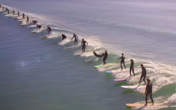
Video above, Sand pumping on the Gold Coast by Craig Halstead
SEE ALSO:
For the 50% of the Australian coast that is composed of sand and in some places mud, the shoreline is prone to change, building seaward and in some places eroding landward. In most locations, this is a natural process with usually no impact on human settlement.
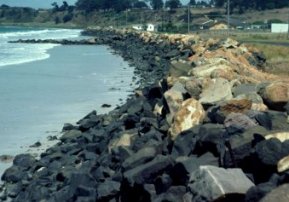
Coastal protection of the shoreline is rarely required in Australia, however in a few locations the dynamic shoreline has become a problem, in some cases a major and expensive problem, and in almost all of these cases the problem is related to human interference or encroachment on the shoreline. Coastal protection works, such as breakwaters, groynes, or seawalls, are usually built to guard against erosion. In doing so they harden the coast and reduce its ability to adjust naturally. As a consequence, these defences can exacerbate further erosional problems, with seawalls reflecting and concentrating wave energy and erosion, and groynes starving downdrift the coast of sediment thereby leading to further erosion.
There are areas where human have encroached into the dynamic beach environment only to suffer the consequences, and others where they have interfered with coastal processes leading to accelerated coastal erosion.
The Cairns waterfront – low, eroding & vulnerable
Cairns, QLD
 Much of the shoreline of the rapidly expanding tropical city of Cairns appears especially vulnerable. The popular marina area and the hub of Cairns has encroached on Trinity Inlet and formerly mangrove-covered mudflats along the seafront are now bare and lined with seawalls, backed by development close to sea level. Much of Cairns is also built on a coastal plain, part of the Barron River delta, with the mangrove-lined tidal creeks that meandered through these plains all that remain. These are inundated at highest tides and demonstrate that critical infrastructure, such as the airport, lie close to present high tide level (as is often also the case with other airports, such as those at Brisbane and Sydney).
At this level much of the coastal plain and city would be inundated by a 2.5m storm surge calculated to accompany a 1 in 100 year storm, whereas dating sequences of coral rubble ridges deposited by large storms on nearby islands indicate that considerably larger events than those known from the past 200 years have recurred frequently over past millennia.
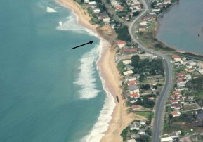
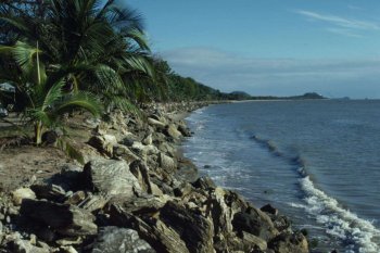
The north Cairns coast along Yorkys Knob-Machans-Holloway beaches is lined with seawalls because much of the shoreline has been retreating, on a coast that in the long-term is building seaward as the Barron River delta progrades. The problem here is both the dynamic shoreline of the delta, which switches channels, has major floods and accompanying pulses of sediment, on a coast exposed to periodic tropical cyclones, all of which produces a highly dynamic shoreline. Roads and houses have been built on parts of the coast which will periodically be reclaimed by the sea, as well as periodically protected by wide beaches. Finally, when climate change is considered, the already perilously low-lying developments in Cairns are at considerable risk to inundation, as discussed in the next section.
Australia’s best known strip of defended coastline, and a major holiday destination for local, national and international tourists, is the 35 km between the New South Wales-Queensland border at Point Danger and the Nerang Inlet, better known as the Gold Coast.
 Here is a system that is part of a northerly conveyor belt of sand moving north from New South Wales across the border at a rate estimated at 500 000 m3/yr. In 1962-64 the Tweed River training walls were extended for navigation, 400m out to sea. The southern wall blocked the movement of sand, which built out the adjacent Letitia Spit by 250m, in the process trapping millions of cubic metres of sand and preventing it from moving across the border and along the Gold Coast beaches.
As the sand supply was depleted, combined with a series of severe cyclones (Dinah, Barbara, Dulcie, Elaine and Glenda) in 1967, 8 million cubic metres of sand was eroded from the beaches and threatened the backing Gold Coast roads, houses and hotels.
The solution has been threefold. First, a continuous terminal seawall was built the length of the coast and covered with sand and dunes. Second between 1995 and 2000 3.5 million cubic meters of sand was dredged from the Tweed Bar and placed offshore of the southern Gold Coast beaches. Third, a permanent pumping system was built just south of the training wall, which since 2000 has pumped more than 500 000 m3 of sand each year from New South Wales across the border onto the Gold Coast beaches. In 2007 these beaches were as wide was they have ever been. However, it has all come at a cost in the tens of millions of dollars.
Brunswick river mouth, Photo by Dan Wyer
A similar training wall built between 1960-66 at the mouth of the Brunswick River, 50 km to the south, to service the small fishing fleet. Studies have shown that the walls impacted the beach to the north and south. The beach built it out for 8km updrift, while erosion was observed to extend up to 17 km downdrift, with the shorelines not stabilising until 1987.
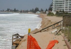
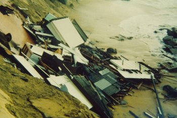
The largest impacts were close to the wall with the small beachfront community of Sheltering Palms, located 2km north of the wall, experiencing up to 90 m of shoreline erosion which resulted in some houses, roads and telegraph poles ending up in the surf zone and finally abandonment of the entire village by the mid 1970’s. Unlike the Gold Coast, this area did not warrant the massive expenditure on protection, so it was sacrificed.